|
My Personal Web Site |
|
...discipline is a habit of taking consistent action, |
|
Home |
|
My Interests |
|
My Photos Gallery |
|
My Favorite Links |
|
Downloads |


|
Enduro Track: Taygetos |
|
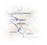
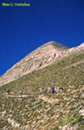
Taygetos, one of the largest Greek mountains is 2404 m high and 40 km long. It is located between the provinces of Messinnia and Lakonia and stretches from the Megalopolis plateau to the Tainaro cape. The Taygetos and Parnon mountains are the two most ancient areas of the Peloponnese. The mountain got its name after nymph Tayget, the daughter of Atlas. The mountain has five peaks and its other name if "Pendadaktilos" (five-fingered). One of these peaks is well known for its pyramidal shape and can be seen from the side of Sparta as well as from Kardamili. The high peaks of Taygetos, such as Profitis Εlias, Xerovouna, Neraidovouna, Zitali and others are usually covered with snow and the alpine zone is located on this height. But at the same time some sparse dolomite rocks are also found here. Taygetos has rich flora and fauna but unfortunately in spite of many efforts it is still not a national reservation as it should be. The Taygetos flora numbers about 160 Greek endemic plants out of which 28 exist only on Taygetos. The Taygetos fauna is rich in reptiles as well as in birds and mammals. Today its fauna includes 85 species of birds, 19 species of mammals and 33 types of reptiles. On Taygetos there are many gorges and ravines, such as the Rindomo ravine and the Viros gorge. It is not at all accidental that the famous tortoise caret-caret has chosen the clean and pure Selinitsa shore (between Githion and Trinisa) as a place to lay eggs. On Taygetos many beautiful caves were found. In the interior of some of them fossil animals have been discovered that existed about 2 million years ago. A lot of different reptiles and mammals such as snakes, scorpions and bats find their shelter inside the caves. Many metals and different sorts of marble as well as construction stones were mined on Taygetos in old days. They include for example the red marble or rosso antico as Romans called it from the Maniot village of Dimariotika (Dimaristika), the Serpentitis marble from Laconia, the Maniot white marble. The majestic Taygetos Mountain dominates the area, while the Tainaro cape of the Maniot peninsula is the most southern point not only of Greece but also of the whole European continent. The deepest point of the Mediterranean (4850m) is located 62 miles to the southwest of the cape. Taygetos south, is hard for enduro. Our proposed track is northbound, starting on the road connecting the towns of Kalamata and Sparti (see waypoint TG899), and ending north, in Loganikos and Kastorio villages. The core track in Taigetos forest roads is no more than 35km. The overall round track, as predented below, is 100km. Recommended gasoline stations to refill at Loganikos, Kastorio, and Mistras. |
|
Mountain: Taygetos Location: Lakonia, Peloponissos, Greece Peak: Profitis Elias, 2,404m altitude @ N 36.95294° E022.35070° Proxmity township: Xirokambi and Sparti |

|
How to reach Taygetos... |

|
Enduro track... |

|
Track waypoints... |

|
Where to stay... |
|
Taygetos Municipal Motel, tel. +30-27210-99236 |


|
Mistras, Lakonia |

|
...more photo’s from Taygetos |