|
My Personal Web Site |
|
...discipline is a habit of taking consistent action, |
|
Home |
|
My Interests |
|
My Photos Gallery |
|
My Favorite Links |
|
Downloads |


|
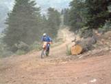
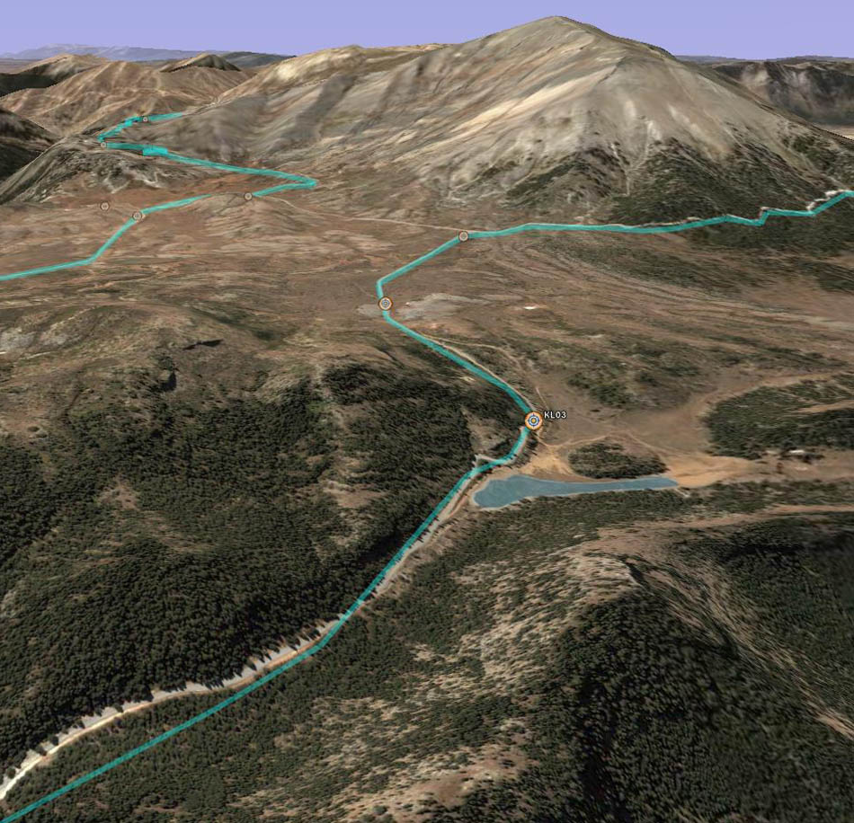
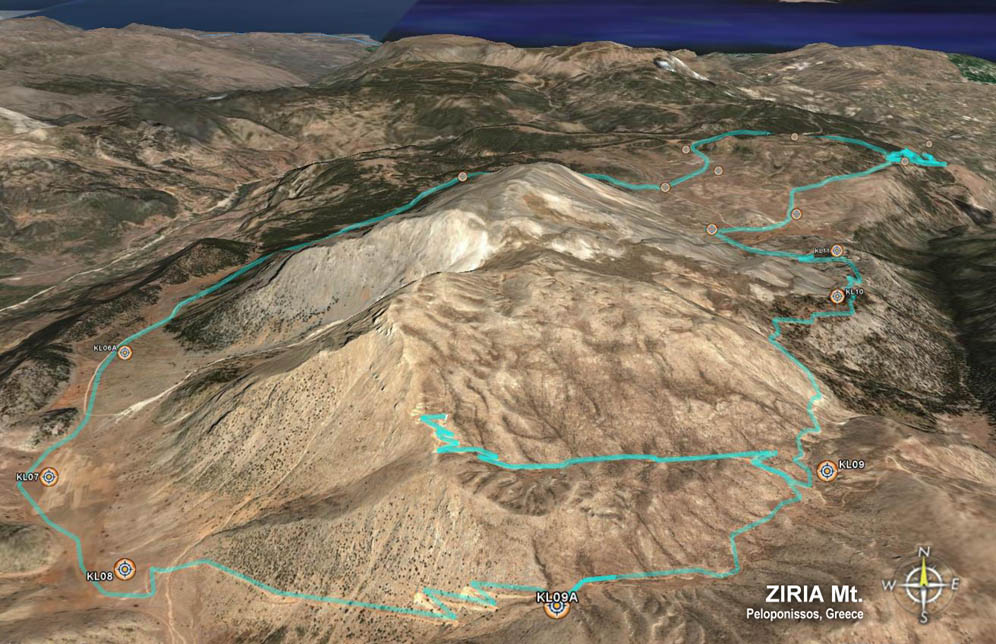
Enduro Track:� Ziria Mt. |
|
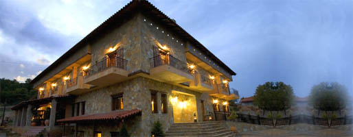
�Ziria� name is having a Slavic origin, and means �acorn� The Ziria mountain, is also called Kilini.� It is located in the northeast of the Peloponissos peninsula in Greece.� The mountain is formed in 4 main peaks, Small Ziria 2,086m, Paraga 2,032m, Profiti Elias 2,257m, and Large Ziria (Simio) 2,374m. Ziria is the second highest mountain of Peloponnese. Rich in flora and fauna, it serves as home to many local, indigenous species. Observant visitors are impressed by its bizarre and splendid plants. You can follow the traced paths leading as far as Goura and arrive in the biotope of Flabouritsa. You can also visit the lake of Dassio or go up to the top of Psili Korfi which lets eyes wander as far as Taygetus on the south and Olympus on the north! All these are depicted in the below linked enduro track, both in a 2D map, and 3D Google Earth� view.�� Hotel �Archontiko Fiamegou� @ Middle (Mesea) Trikala Korinthias: +30-27430-91188. Contact for Hermes Refugee: Nikos Tsatalios, Ano Trikala: +30-27430-91452. |
|
Mountain: Ziria Location: Korinthia Prefecture, Greece Peak: Simio,� 2,374m altitude @� N 37�56.344'�� E 22�23.734' Proxmity town: Ano Trikala Korinthias |


|
Enduro track... |
|
Track waypoints... |
|
Œ File in �gpx� format� (after downloading, rename to �gpx�) |